
The A-PLAT Pro is one of the servers developed and operated by Center for Climate Change Adaptation, National Institute for Environmental Studies. It was released in April 2021 to collect and distribute numerical climate data useful for climate change impact assessment and adaptation studies. Since most of the data is research-based, this site is intended primarily for researchers and engineers who have the necessary background knowledge.
Climate change prediction is carried out in two stages. First, emission scenarios are assumed how greenhouse gases, which are the cause of climate change, may be emitted in the future. Next, computer simulations are used to produce the climate scenario of how the climate will change due to the greenhouse gases described in the emission scenarios.
Impact models are tools that predict the reactions and state in specific subject for the climate conditions. By inputting climate scenarios into these impact models, we can obtain climate change impacts prediction.
In this climate change impact prediction, there are two important numerical data. The first is the climate scenario, which serves as the input (boundary condition) for impact models. Climate scenarios are time series of numerical data for the entire world or Japan, separated by an equally spaced grid, and consist of multiple meteorological variables such as air temperature and precipitation. The second is the impact prediction output by the impact models and climate scenarios.
A-PLAT Pro provides various climate scenarios. Climate scenarios are based on emission scenarios and do not accurately predict future climate. However, by using common climate scenarios in many impact models, an overall picture of global and Japanese climate change impacts across multiple sectors can be projected. The common and harmonized climate scenarios is a key challenge in forecasting the impacts of climate change, and A-PLAT Pro plays a part in this.
A-PLAT Pro is available free of charge, but users are required to register and log in. This is to protect computer resources from invalid access. Users can claim their account from the Sign In page. Please comply with the terms of use of each data.
A-PLAT Pro offers four web interfaces to access the numerical data provided: "Data Downloader", "Time Series Viewer", "Map Viewer", and "Analysis Tool". Through the interface, users can select the meteorological variables (air temperature, precipitation, etc.), data period, spatial area, spatial resolution, etc. of the required climate scenario, and download numerical data in NetCDF format according to their selections (Data Downloader). You can draw a spatial distribution map in the selected area (Map Viewer) or a time series graph at the selected point (Time Series Viewer) for a specific meteorological variable, You can also obtain time series data of the average, sum, maximum, and minimum values of meteorological variables in a specific point or an administrative district (Analysis Tool).
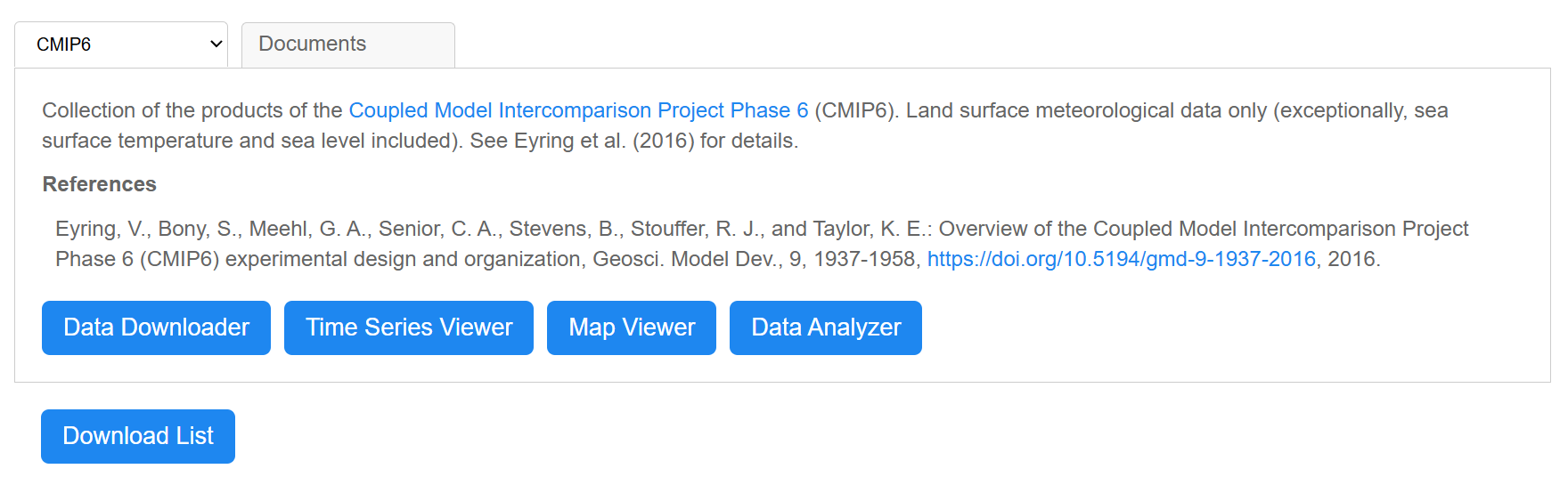 Selecting a Dataset and Service Menu
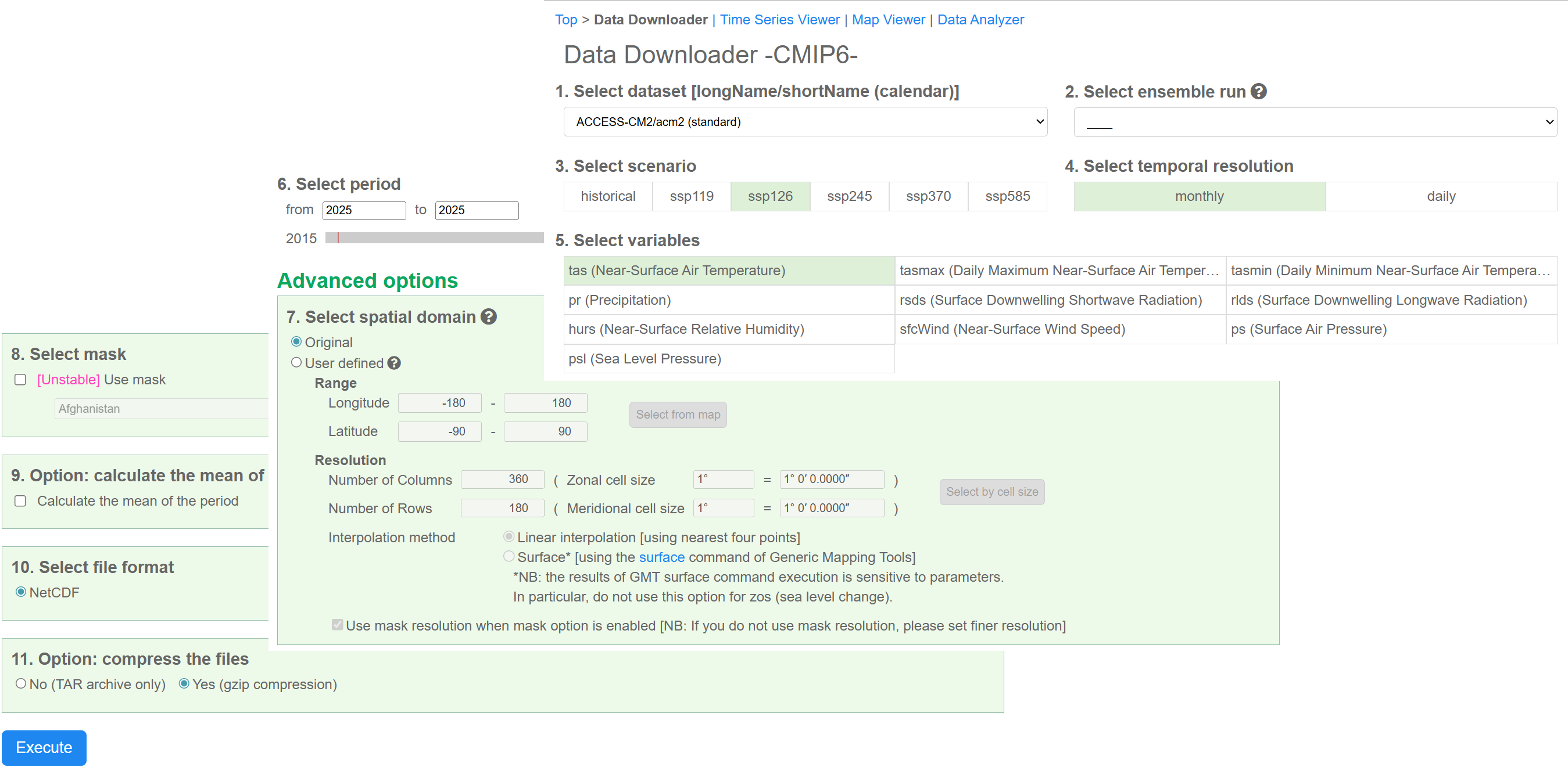 Data Downloader
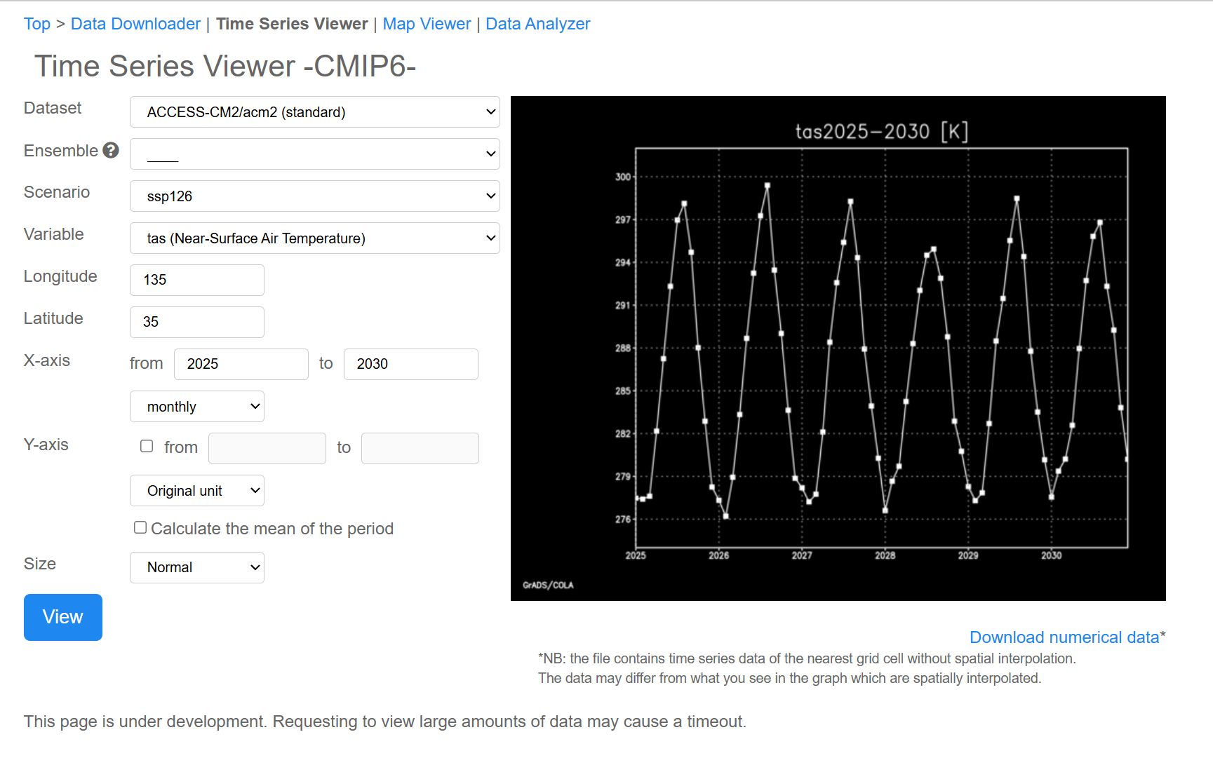 Time Series Viewer
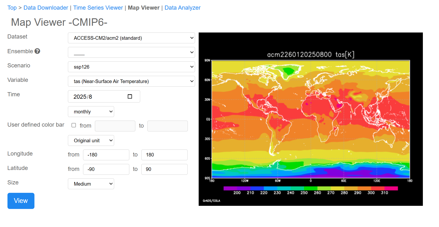 Map Viewer
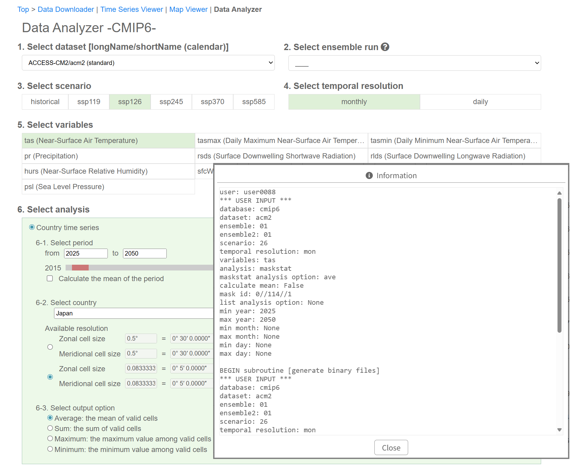 Data Analysis by administrative area
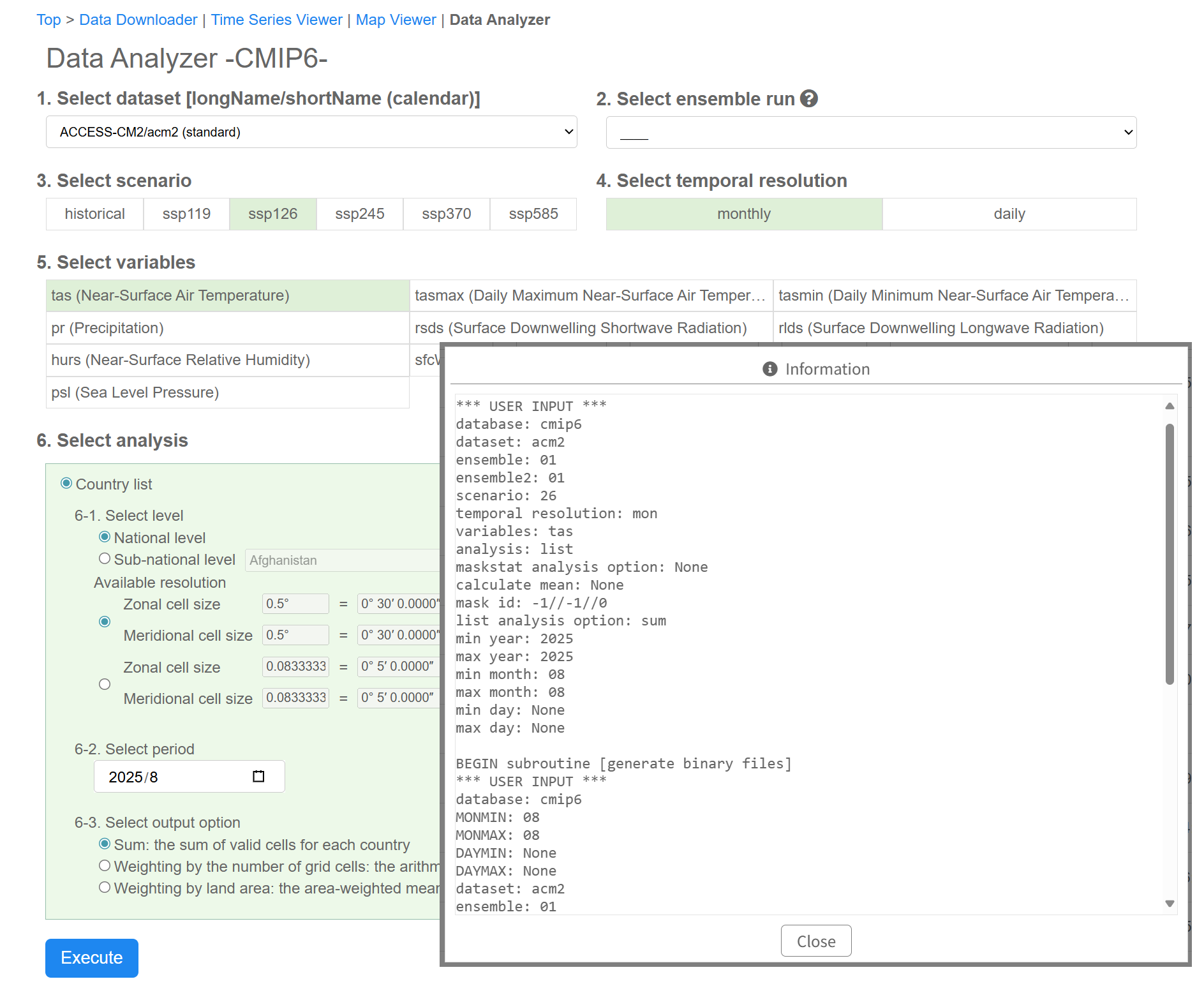 Data Analysis of specific administrative areas
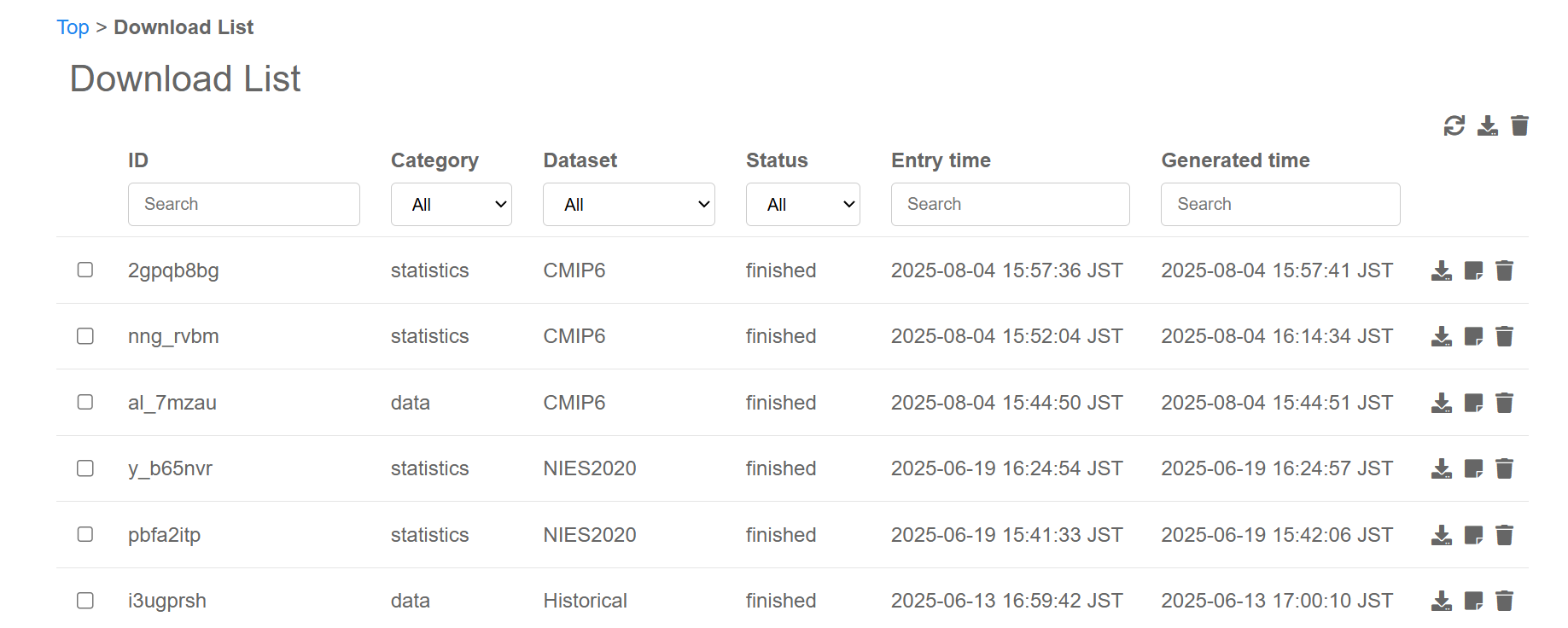 Download List